History
![]()
![]()
![]()
![]()

LOFTIN
GENEALOGY
LINE
The
LOFTIN
Family
Tree
The
SETZER
Family
Tree
The
GOBLE
Family
Tree
The
JOHNSON
Family
Tree
_______
LINKS
History of
NC Counties
CARS
Catawba
Station
Township
Catawba
Elementary
& High School
Cemeteries
The
CIVIL
WAR
Additional
Family
SURNAMES
Genealogy
HUMOR
PHOTO
LINKS
Slavery
Twins
WHERE
TO
FIND 'EM
PAGE
________
FAMILY
NAMES
LOFTIN:
Beatty
Corzine
Cranford
Fisher
Givens
Harwell
Kaiser
Lanier
Lomax
McCorkle
Rudisill
Sherrill
Upright
Washington
Work
SETZER:
Aderholdt
Barringer
Bovey
Bushart
Deal
Heavner
Herman
Ikert
Miller
Motz
Rankin
Witherspoon
GOBLE:
Babst/Bobst
Douglas
Faber
Fink
Fulbright
Hefner
Meinhert
Miller
Muller
Pabst/Bobst
Robinson
JOHNSON:
Corzine
Fink
Hamilton
Kaiser
Leslie
Lewis
Moore
Sherrill
Upright
Wilkinson
Early North Carolina County History
Tyron County is a former county located in the state of North Carolina. It was formed in 1768 from the part of Mecklenburg County west of the Catawba River, though the legislative act that created it did not become effective until April 10, 1769. It was named for William Tryon, Governor of North Carolina from 1765 to 1771. In 1779 Tryon County was divided into Lincoln County and Rutherford County and Tryon County ceased to exist.
Tryon County played an important early role in the American Revolution. Residents of the county actively organized into committees of safety and later a county militia to prepare against the British following the Battle of Lexington in Massachusetts. On August 14, 1775, forty-nine Tryon County residents gathered at the county courthouse and issued a declaration of grievances against the British known as the Tryon Resolves. They were among the earliest colonists to do so.
Lincoln County was formed in 1779 from the eastern part of Tryon County. It was named for Benjamin Lincoln, a general in the American Revolutionary War.
In 1782 the southeastern part of Burke County was annexed to Lincoln County. In 1841 parts of Lincoln County and Rutherford County were combined to form Cleveland County. In 1842 the northern third of Lincoln County became Catawba County. In 1846 the southern half of what was left of Lincoln County became Gaston County.
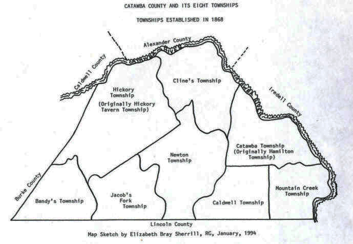
Most of the Loftins lived in Cline, Catawba/Hamilton and Mountain Creek Townships Burke County was formed in 1777 from Rowan County. It was named for Thomas Burke, a delegate to the Continental Congress from 1777 to 1781 and Governor of North Carolina from 1781 to 1782. In 1791 parts of Burke County and Rutherford County were combined to form Buncombe County. In 1833 parts of Burke County and Buncombe County were combined to form Yancey County. In 1841 parts of Burke County and Wilkes County were combined to form Caldwell County. In 1842 additional parts of Burke County and Rutherford County were combined to form McDowell County. Finally, in 1861 parts of Burke County, Caldwell County, McDowell County, Watauga County, and Yancey County were combined to form Mitchell County.
Catawba County was formed in 1842 from Lincoln County. It was named for the Catawba tribe of Native Americans who once inhabited the area.
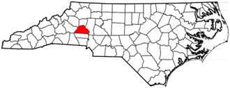
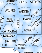
The present land area is 399.97 square miles. Catawba County is boarded by Alexander County (north), Iredell County (east), Lincoln County (south), Burke County (west) and Caldwell County (northwest. The county is divided into eight townships; Bandy's Caldwell, Catawba, Clines, Hickory, Jacobs Fork, Mountain Creek, Newton, and Longview. Cities, towns and communities in Catawba County include Brookford, Catawba, Claremont, Conover, Hickory, Lake Norman, Maiden, Mountain View, Newton, Sherrills Ford, Longview, St. Stevens and Vale.
Catawba County (formed in 1842) was originally part of Lincoln County, Lincoln (1779) was part of Tryon, Tryon (1768) was part of Mecklenburg, Mecklenburg (1763) was part of Anson, Anson (1750) was part of Bladen, Bladen (1734) was part of New Hanover, New Hanover (1729) was part of Craven, Craven (1705) was part of Bath (which was also Archdale from 1705 - 1712), Bath (1696) was an original county and was extinct after 1724.
A person blessed with longevity could have been born in Rowan County in 1753, married in Burke County in 1778, fathered children in the counties of Burke and Lincoln in the 1780s and died in 1842 during Catawba County's formation year while living on the same land all the while. His land simply became part of the new counties as they were formed.